
1
2
3
4
5
6
7
8
9

10
11
12
13
14
15
June 29, 2010 - Switzerland - Kandersteg, Bundalp
Prev | Next
1 |
2 |
3 |
4 |
5 |
6 |
7 |
8 |
9 |
10 |
11 |
12 |
13 |
14 |
15 |
16 |
17 |
 18 |
19 |
20 |
21 |
 22 |
23 |
24 |
25 |
26 |
27 |
28 |
29 |
30 |
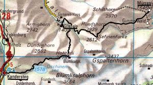
The big attraction for us in Switzerland was to do a two day hike between Murren and Kandersteg. This involves crossing two passes that are approximately 9,000 feet high, with an overnight stay in the very small town of Greisalp. I'd called the Sonnenburg hotel near Murren three weeks earlier to find out if the snow level would be low enough to do this hike without ropes, crampons, ice axes and the like. They told me they thought it would be, so went for it. Indeed this is a spectacular hike, even for seasoned hikers like us who've been through the Olympics and Cascades of Washington state. The scale of mountains in Switzerland is different than Washington. Each day of this hike consisted of hiking uphill for half a day to the pass, then downhill to our lodging at the end of the day. Normally in the Olympics or Cascades you make several ascents and descents through passes and valleys per day. It seemed odd, grueling, satisfying and dare I say epic to do this giant pass route. Here's a map of our route:
On this first day of the hike we got up around 7:00. Went down to breakfast after showering. A nice German-style spread with my very own little pot of coffee. Met a super nice English guy that gave us tips on our hike for the day. We were amused when he asked us if we'd ever hiked this section of trail this time of year. How would he know that we don't do this all the time? He said the snow might be a problem on the north side of the pass, but that we could always hike back down again and take a bus around. I don't think so. He showed us his maps and warned us about a wrong turn to avoid on the second day. Said Lauderbrunen valley was "infested with tourists". Thank you Rick Steves for once again guiding to a crowded place. At least our hike to Lauderbrunen would be uncrowded. We asked our host Phillip to call the Griesalp hotel for reservations that night, but no answer from them. We also asked about the difference between Swiss-German dialect and normal German. He gave some examples and said normal German is more formal, and that every village has its own dialect. He said he can't understand farmers from Adelboden only 20km away, and that people from Zurich speak completely differently from people here. We packed up after breakfast and headed up the valley. We basically walked up hill until about 2:00 PM after starting at 9:00 AM. And I mean REALLY uphill. Started at 1,200 meters and the pass was at 2778 meters. 5260 foot elevation gain, with the pass at 9260 feet high. Encountered free public bathrooms on the way up, what a concept. Italians take note.
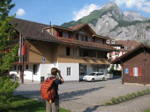
Leaving Zur Poste hotel on a spectacular morning.
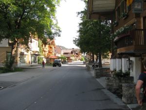
The near vacant streets of Kandersteg early in the morning.
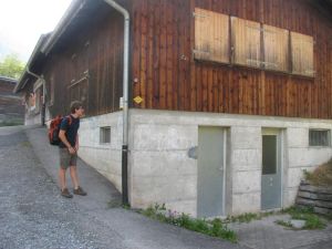
Public restrooms! Wow!
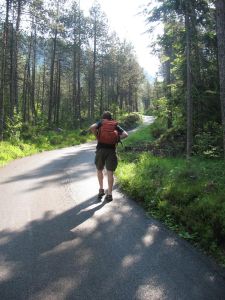
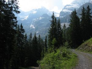
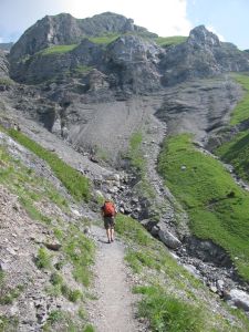
Our ascent began with paved service roads. Little did we know...
A water fall comes into view.
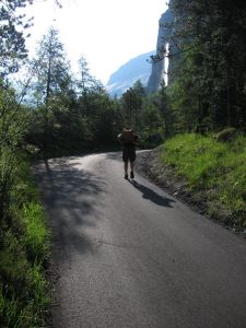
Looking back down at Kandersteg.
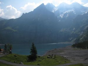
Our English friend suggested we take a high trail by the Oeschinensee (lake) for better views, which we did. Nice glacier colored water with a backdrop of glacier-clad mountains. Cows were down by the lake on the beach doing what we didn't know since there was no grass there. Cows also in the hills, all with bells. Seems the bigger the cow the bigger the bell.
Reaching the Oeschinensee.
Heading up the high trail above the Oeschinensee.
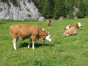
Swiss cows with bells. Klong, klong, kling kling.
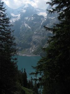
The Oeschinensee below.
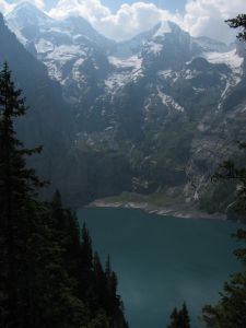
The Oeschinensee again.
The high trail above the Oeschinensee.
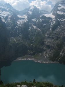
The Oeschinensee below.
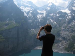
Max capturing the view.
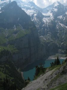
The Oeschinensee below.
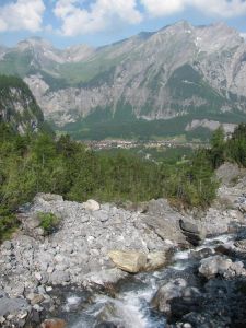
We passed through the little village of Oberbergli, which was just a few barns butressed with stones for avalance protection. Then saw some large interesting mammals with hooves and extrodinary horns, possibly a mountain goat or sheep of some kind.
Leaving the valley with the Oeschinensee. The village of Oberbergli in the distance.
Oberbergli, which was really just a few barns and rustic houses.
Stone buttresses protecting the buildings. Makes you think about avalanches. They wouldn't pile all these rocks up for nothing.
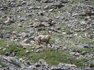
A strange horned, hoofed animal.
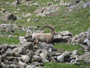
Here it is frolicking.
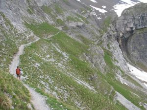
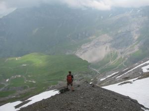
Getting above the tree line now.
The hills are alive...
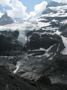
Glaciers as we get closer to the pass.
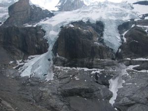
A closer look at the same glaciers.
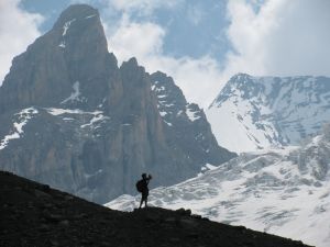
Max on a small ridge.
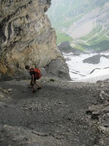
Skirting a drop off.
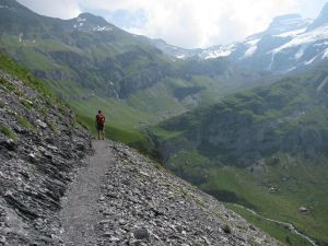
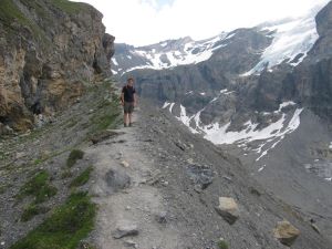
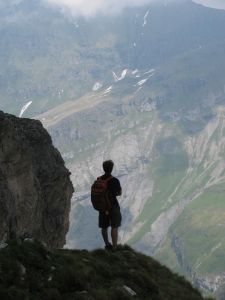
A view of the pass in the distance, just to the right of the big cliffs in the center of the picture. Max hiked a bit faster than me uphill. Actually downhill too, and on level ground. Hmmmm.
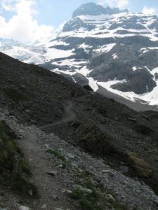
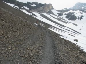
The trail got very steep as we neared the Hohturli pass, and then we hit some snow patches. Our low, versatile adventure shoes let some snow in no matter how much we tried to avoid wet socks. Very tricky and slippery footing. Almost everyone else had walking sticks and pooh-pooh'd our shoes when I asked about the snow on the other side of the pass. The Bluemlisalphutte was at the top of the pass, but enough off the trail so that we didn't venture up there for lunch, or for the Kaffe and Kuchen as advertised on a sign. We had our picnic lunch at the top, with amazing views of course. The wind was blowing up there and the temperatures had dropped a bit. Some hikers were wearing fleece.
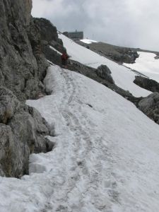
The pass and the Bluemlisalphutte are near now. No way around the snow though.
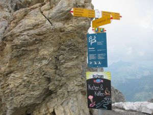
Finally at the pass. Note the 'Kuchen & Kaffee' sign at the bottom.
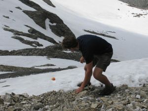
I dropped an apple during lunch and Max risked life and limb to retrieve it.
Then we started down the north side. Chains and ropes are present in some places, but the snow has buried the ropes, and you couldn't pull them out. Very slippery in the snow going down. We had to jam our heels into the snow to make steps. Walking sticks would have been helpful. It was a very, very long way down towards Griesalp. The rain started to fall near 4:00 PM and my knees hurt from the steep descent. Max of course was unfazed. We were a bit concerned about hikers close behind us beating us to our hotel and getting the last room.
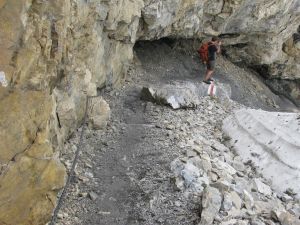
Starting the descent to Greisalp. Chains on the left side of the trail.
No snow here. This was steep.
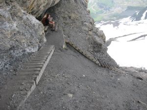
Stairs help on the steep parts. The bench is thoughtful.
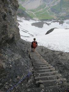
Max descending stairs to a snowfield.
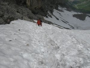
Max on a snowfield. Dangerous? Mmmmmmm, yes.
Max pondering.
Descending to vegetation level.
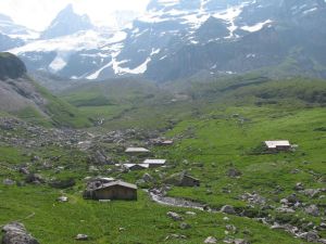
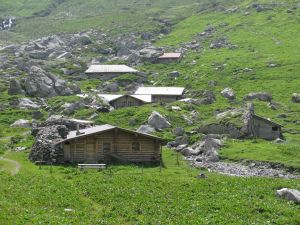
We finally got down to near-level terrain and found Berghaus Bundalp. It's a wonderful litle lodging place that also serves meals, and it was a mile or so closer than the town of Griesalp where we had intended to stay. We got a double room in a classic, chalet building with views of the mountains, plus breakfast and dinner for 55 francs per person. The rain and wind had picked up by then, and by the time we had our packs in our room thunder was rumbling. SAVED, whew! Did a bit of laundry, took a shower, then off to dinner for roast beef, potatoes and salad. Good beer too. Tomorrow to Murren, but now to bed.
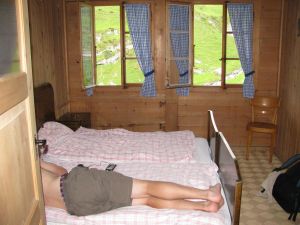
At last in our wonderful room in Bundalp. Max resting after the day's ascent and descent.
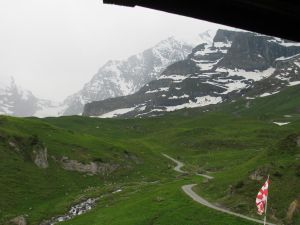
A view out our room's window. The clouds had socked in and the rain had begun to fall in earnest, complete with thunder.
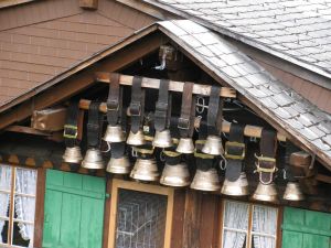
Cowbells on the main house where we ate dinner and breakfast.
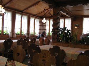
The Bundalp dining room.

Our room was the one with the top center windows.
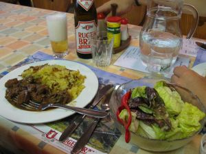
Dinner at our hotel in Bundalp. Roast beef, potatoes and salad. Fabulous.
Prev | Next
1 |
2 |
3 |
4 |
5 |
6 |
7 |
8 |
9 |
10 |
11 |
12 |
13 |
14 |
15 |
16 |
17 |
18 |
19 |
20 |
21 |
22 |
23 |
24 |
25 |
26 |
27 |
28 |
29 |
30 |